
Navitel Navigator features

Map subscriptionA convenient way to purchase: an annual subscription on maps or a lifetime license. Map subscription is available only from the "My Navitel" section of the program menu.

Navitel.TrafficReal-time information on traffic jams for a map coverage area.

Navitel.FriendsMessage exchange with friends, tracking their location and routing toward them.

Navitel.WeatherInformation on weather in any location in the world for the following three days.

Dynamic POIFuel prices, cinema showtimes and other useful information.

Navitel.EventsRoad accidents, road works, speed cameras and other information added to a map by users.

Navitel.SMSMessage exchange with friends while navigation.

SpeedCam WarningInformation on radars, video recording cameras and speed humps.

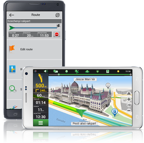
3D-CartographyThree dimension maps showing structure and height of buildings.

3D-Multi-level interchangesDisplay of multi-level transport interchanges in 3D-mode.

Road lanesCalculation of a route taking into account multilane roads and visual prompts while moving along the route.

Multilanguage systemSupport of the interface and voice prompts in several languages.

Voice promptsVoice guide while moving along a route, warning on battery charge and connection to satellites.

Onboard computerMore than100 various sensors: time, speed, weather conditions and other parameters.

Purchase through programme menuPurchase of new map packages and update of the purchased ones through "My Navitel" menu.

Quick routingInstantaneous calculation and building of a route of any length and complexity.

Unlimited number of points for routingEasy routing with unlimited number of itinerary points.

Adjustable interfaceAdjustable programme interface and map display modes.

Multi-touchQuick access to map scaling and rotation functions by multi-touch input.