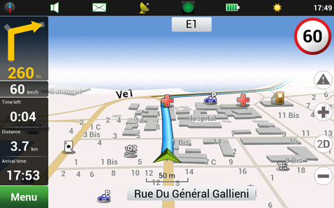
Update Q3 2012: map of New Caledonia for Navitel Navigator!
4 December 2012
Navitel map coverage has extended: company announces the release of official navigation map of New Caledonia with online services “Navitel.Traffic”, “Navitel.SMS”, “Navitel.Events”, “Navitel.Weather” and “Dynamic POI” support on the territory of all countries.

New official map of New Caledonia release Q3 2012 is available to all Navitel users!
Residential and industrial city infrastructure with address search, detailed road network, streets and roads, roundabouts, lanes is included into all maps.
Detailed information on New Caledonia map Q3 2012:
• 9491,652 km of road network.
• 377 cities and municipalities.
• 1228 POI.
Recommended retail price of licenses:
| Navitel Navigator with map of New Caledonia | 20 € per license |
| Map of New Caledonia | 16 € per license |
To buy new products, use , or for appropriate platforms.
ATTENTION! Map of New Caledonia release Q3 2012 properly works with Navitel Navigator version 5.5.1.0 or later.

