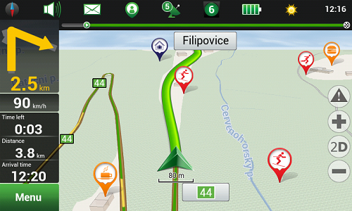
“Mountain resorts” special offer from NAVITEL®!
NAVITEL® releases navigation map packages specially for those who prefer active winter holidays!

Only from December 23, 2013 till March 31, 2014 users of Android, Windows Mobile, Windows Phone and BlackBerry smartphones and tablets are offered a great opportunity to purchase “Alps”, “Caucasus”, “Carpathians” and “Pyrenees” special winter season products at special prices.
Detailed information on new products and suggested retail price:
| Product | Maps | Retail price (electronic licence) |
| Navitel Navigator. Alps | Austria, France, Germany, Italy, Liechtenstein, Monaco, Slovenia, Switzerland | 32 EUR |
| “Alps” navigation map package | Austria, France, Germany, Italy, Liechtenstein, Monaco, Slovenia, Switzerland | 28 EUR |
| Navitel Navigator. Caucasus | Azerbaijan, Armenia, Georgia, North Caucasus Federal District of Russia | 32 EUR |
| “Caucasus” navigation map package | Azerbaijan, Armenia, Georgia, North Caucasus Federal District of Russia | 28 EUR |
| Navitel Navigator. Carpathians | Czech Republic, Hungary, Poland, Romania, Serbia, Slovakia, Ukraine | 32 EUR |
| “Carpathians” navigation map package | Czech Republic, Hungary, Poland, Romania, Serbia, Slovakia, Ukraine | 28 EUR |
| Navitel Navigator. Pyrenees | Andorra, France, Spain | 32 EUR |
| “Pyrenees” navigation map package | Andorra, France, Spain | 28 EUR |
The “Alps” navigation map package includes maps of Austria, France, Germany, Italy, Liechtenstein, Monaco, Slovenia, Switzerland, which contain a total of 3 657 607 km of road graph, 3 001 704 POIs, 239 259 cities, towns and other settlements, providing road network plans and allowing address search for 112 620 of them.
The “Caucasus” navigation map package includes maps of Azerbaijan, Armenia, Georgia, the North Caucasus Federal District of Russia, which contain a total of 317 134 km of road graph, 51 849 POIs, 13 192 cities, towns and other settlements, providing road network plans and allowing address search for 326 of them.
The “Carpathians” navigation map package includes maps of Czech Republic, Hungary, Poland, Romania, Serbia, Slovakia, Ukraine, which contain a total of 2 267 643 km of road graph, 455 333 POIs, 151 984 cities, towns and other settlements, providing road network plans and allowing address search for 21 043 of them.
The “Pyrenees” navigation map package includes maps of Andorra, France, Spain, which contain a total of 2 075 402 km of road graph, 1 966 466 POIs, 111 690 cities, towns and other settlements, providing road network plans and allowing address search for 59 586 of them.
The “Alps”, “Caucasus”, “Carpathians” and “Pyrenees” navigation map packages contain all necessary information, which may be necessary for a tourist during a journey! Highly detailed plans of cities, towns and other settlements include a wide range of points of interest: hotels, restaurants, cafes and bars, sites of tourist attraction, shops, petrol stations and maintenance facilities, hospitals and chemists and many others, which will help you to find your way in a new country and have a great time, and instantaneous route calculation taking into account traffic situation will help to reach the necessary point in the shortest possible time.
You can purchase licence keys to special winter season products from December 23, 2013 till March 31, 2014 at How to buy section of NAVITEL® website.

